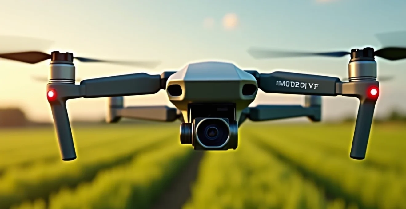
The agricultural landscape is evolving rapidly, with drones emerging as powerful tools for precision farming. These unmanned aerial vehicles (UAVs) are revolutionising crop management, offering farmers unprecedented insights into their fields. From multi-spectral imaging to automated monitoring systems, drone technology is enhancing productivity, reducing costs, and promoting sustainable farming practices. As we delve into the world of agricultural drones, we’ll explore how this cutting-edge technology is transforming the way farmers map, monitor, and manage their crops.
Precision agriculture revolution: UAV technology in crop management
Precision agriculture harnesses the power of technology to optimise crop yields while minimising resource use. Drones play a pivotal role in this revolution, providing farmers with high-resolution data that was previously unattainable or prohibitively expensive to gather. These aerial platforms can cover vast areas quickly, capturing detailed information about crop health, soil conditions, and field topography.
One of the key advantages of using drones in agriculture is their ability to provide real-time data. This timely information allows farmers to make informed decisions about irrigation, fertilisation, and pest control. By identifying problem areas early, farmers can take targeted action, potentially saving entire crops from disease or infestation.
Moreover, drones equipped with specialised sensors can detect subtle variations in crop health that are invisible to the naked eye. This early warning system enables proactive management, rather than reactive problem-solving. As a result, farmers can optimise their use of resources, reducing waste and environmental impact while maximising yield and profitability.
Multi-spectral imaging for crop health assessment
Multi-spectral imaging is a game-changer in agricultural drone applications. This technology allows drones to capture data across multiple bands of the electromagnetic spectrum, revealing insights about crop health that go far beyond what’s visible to the human eye. By analysing the reflectance of light at different wavelengths, farmers can gain a comprehensive understanding of their crops’ vigour, stress levels, and nutrient status.
NDVI analysis using DJI phantom 4 multispectral
The Normalized Difference Vegetation Index (NDVI) is a widely used metric in precision agriculture. The DJI Phantom 4 Multispectral drone is specifically designed for NDVI analysis, offering farmers a powerful tool for assessing crop health. This drone captures both visible and near-infrared light, allowing for the calculation of NDVI values across entire fields.
NDVI analysis provides valuable insights into plant photosynthetic activity and biomass. Healthy plants with high chlorophyll content reflect more near-infrared light, resulting in higher NDVI values. Areas of stress or poor growth show lower NDVI values, enabling farmers to pinpoint problem areas quickly and efficiently.
Thermal imaging with FLIR vue pro R for water stress detection
Water stress is a critical factor in crop health and yield. The FLIR Vue Pro R thermal camera, when mounted on a compatible drone, allows farmers to detect water stress before visible symptoms appear. By measuring the temperature differences across the crop canopy, thermal imaging can reveal areas of inadequate irrigation or drainage issues.
This technology is particularly valuable in regions prone to drought or where water conservation is crucial. By identifying areas of water stress early, farmers can optimise their irrigation strategies, ensuring efficient water use while maintaining crop health.
RGB sensors and visual spectrum analysis in field scouting
While advanced spectral imaging offers powerful insights, traditional RGB (Red, Green, Blue) sensors still play a vital role in agricultural drone applications. High-resolution RGB cameras provide detailed visual information about crop appearance, growth patterns, and overall field conditions.
RGB imagery is particularly useful for detecting obvious signs of crop stress, pest infestations, or weed outbreaks. It also serves as an excellent tool for general field scouting, allowing farmers to quickly assess large areas and identify zones that require closer inspection.
Hyperspectral imaging: advanced crop diagnostics with headwall Nano-Hyperspec
For the most advanced crop diagnostics, hyperspectral imaging takes multi-spectral analysis to the next level. The Headwall Nano-Hyperspec sensor, designed for UAV integration, captures hundreds of narrow spectral bands across the visible and near-infrared spectrum. This detailed spectral information allows for highly specific crop analysis, including early disease detection and precise nutrient deficiency identification.
Hyperspectral imaging can differentiate between subtle variations in plant chemistry, enabling farmers to detect and address issues before they become visible or widespread. While the technology is complex, the insights it provides can lead to significant improvements in crop management and yield optimisation.
Drone-based field mapping and surveying techniques
Beyond crop health assessment, drones are revolutionising field mapping and surveying. These aerial platforms can quickly and accurately create detailed maps of agricultural land, providing valuable information for planning and management. From precise boundary mapping to 3D terrain modelling, drone-based surveying offers a level of detail and efficiency that traditional methods struggle to match.
RTK GPS integration for Centimetre-Level accuracy
Real-Time Kinematic (RTK) GPS technology takes drone mapping accuracy to new heights. By integrating RTK GPS systems into drones, farmers can achieve centimetre-level precision in their field maps. This level of accuracy is crucial for applications such as precise planting, variable rate application of inputs, and automated machinery guidance.
RTK-enabled drones use base stations or network corrections to enhance the accuracy of standard GPS signals. This results in highly precise georeferenced data, allowing for the creation of extremely accurate field maps and the ability to return to specific points in the field with pinpoint accuracy.
3D terrain modelling using Pix4Dmapper software
Pix4Dmapper is a powerful photogrammetry software that transforms drone-captured images into detailed 3D terrain models. These models provide valuable insights into field topography, drainage patterns, and erosion risks. By understanding the nuances of their field’s terrain, farmers can make informed decisions about land management, irrigation system design, and crop placement.
3D terrain models also serve as excellent tools for visualising and communicating field conditions. They can be used to plan earthworks, design water management systems, and even simulate the effects of potential landscape changes.
Lidar technology in crop canopy measurement
Light Detection and Ranging (LiDAR) technology is making waves in agricultural drone applications. LiDAR sensors emit laser pulses and measure the time it takes for the light to reflect back, creating highly accurate 3D point clouds of the surveyed area. In agriculture, LiDAR is particularly useful for measuring crop canopy height and density.
LiDAR data can provide insights into crop growth rates, biomass estimation, and even yield prediction. It’s especially valuable in forestry and orchard management, where understanding the structure and health of trees is crucial. The ability to penetrate through gaps in the canopy also makes LiDAR an excellent tool for assessing understory vegetation and soil conditions.
Orthomosaic generation for precise field boundary mapping
Orthomosaic maps are composite images created by stitching together multiple aerial photographs and correcting for perspective and terrain. These high-resolution, georeferenced maps provide a detailed overview of entire fields, making them invaluable for precise boundary mapping and area calculations.
Orthomosaics serve as excellent base maps for various agricultural applications, including crop monitoring, yield mapping, and planning field operations. They can be easily integrated into farm management software, providing a visual reference for decision-making and record-keeping.
Automated drone systems for continuous monitoring
The future of agricultural drones lies in automated systems that can provide continuous monitoring of fields with minimal human intervention. These systems combine advanced drone technology with sophisticated software to deliver regular, consistent data about crop conditions and field status.
Dronedeploy’s live map feature for Real-Time field intelligence
DroneDeploy’s Live Map feature represents a significant advancement in real-time field intelligence. This technology allows drones to process and display map data in real-time, even while the drone is still in flight. Farmers can see a live, low-resolution map of their fields as the drone flies, enabling immediate decision-making based on current field conditions.
Live Map is particularly useful for quick assessments of large areas, allowing farmers to identify areas of concern and make decisions about where to focus their ground-level inspections. This real-time capability can save significant time and resources in managing large agricultural operations.
Implementing sentera’s FieldAgent for autonomous flight planning
Sentera’s FieldAgent software takes drone automation to the next level by enabling autonomous flight planning and execution. This system allows farmers to pre-plan drone missions, specifying flight paths, altitudes, and data capture parameters. The drone can then execute these missions autonomously, returning to base when the flight is complete or when battery levels are low.
Autonomous flight planning ensures consistent data collection over time, which is crucial for tracking changes in crop health and field conditions. It also reduces the need for skilled drone operators, making the technology more accessible to a broader range of farmers.
Cloud-based data processing with agisoft metashape
Agisoft Metashape is a powerful photogrammetry software that enables cloud-based processing of drone-captured imagery. This cloud processing capability allows farmers to generate high-quality orthomosaics, digital elevation models, and 3D reconstructions without the need for powerful on-site computing resources.
Cloud-based processing streamlines the workflow from data capture to analysis, making it easier for farmers to integrate drone technology into their daily operations. It also facilitates data sharing and collaboration, allowing farmers to consult with agronomists or other experts remotely.
Integrating drone data with farm management systems
The true power of agricultural drone technology is realised when drone-captured data is seamlessly integrated with existing farm management systems. This integration allows for comprehensive analysis and decision-making, combining drone-derived insights with other crucial farm data.
API connections to john deere operations center
John Deere’s Operations Center is a central hub for farm management, and its API connections allow for seamless integration of drone data. By connecting drone mapping software to the Operations Center, farmers can overlay drone-captured imagery with other field data, such as yield maps, soil samples, and equipment tracking information.
This integration enables more comprehensive field analysis and informed decision-making. For example, farmers can correlate areas of low crop vigour identified by drone imagery with soil nutrient levels or previous years’ yield data, leading to more targeted and effective management strategies.
Synchronising UAV imagery with trimble ag software
Trimble Ag Software offers robust farm management tools, and its ability to synchronise with UAV imagery enhances its capabilities. By importing drone-captured maps and data into Trimble Ag Software, farmers can create a comprehensive digital record of their fields, tracking changes over time and across various parameters.
This synchronisation allows for the creation of variable rate application maps based on drone imagery, enabling precision application of inputs such as fertilisers and pesticides. It also facilitates better record-keeping and compliance reporting, which is increasingly important in modern agriculture.
Machine learning algorithms for crop yield prediction
Machine learning algorithms are increasingly being applied to drone-captured data to predict crop yields. These algorithms analyse multiple data points, including spectral imagery, weather data, and historical yield information, to forecast potential yields with increasing accuracy.
Yield prediction models can help farmers make crucial decisions about resource allocation, harvest timing, and marketing strategies. As these algorithms become more sophisticated and are fed with more data, their predictive power continues to improve, offering valuable insights for farm management.
Variable rate application maps from Drone-Collected data
One of the most practical applications of drone technology in precision agriculture is the creation of variable rate application maps. By analysing drone-captured imagery, farmers can create detailed maps showing variations in crop health, soil conditions, or other relevant factors across their fields.
These maps can then be used to guide variable rate application of inputs such as fertilisers, pesticides, or water. By applying inputs only where they’re needed and in the appropriate amounts, farmers can optimise resource use, reduce costs, and minimise environmental impact while maximising crop yields.
Regulatory compliance and best practices for agricultural drone operations
As drone technology becomes more prevalent in agriculture, understanding and adhering to regulatory requirements is crucial. Compliance ensures safe and legal drone operations while also protecting privacy and data security.
UK civil aviation authority regulations for commercial drone use
In the UK, the Civil Aviation Authority (CAA) regulates the use of drones for commercial purposes, including agricultural applications. Operators must understand and comply with the Air Navigation Order, which outlines rules for drone flights, including height restrictions, distance limitations, and operational boundaries.
Commercial drone operators in agriculture must register with the CAA and obtain the appropriate permissions for their specific operations. This may include permissions for flying beyond visual line of sight (BVLOS) or in congested areas, which can be particularly relevant for large-scale agricultural operations.
Drone pilot certification: A-2 CofC requirements
The A-2 Certificate of Competency (CofC) is a qualification for drone pilots operating in the ‘Open’ category under UK and EU regulations. This certification is particularly relevant for agricultural drone operators, as it allows for flights closer to uninvolved people, which can be necessary in some farming contexts.
To obtain the A-2 CofC, pilots must complete a theory course and pass an exam covering topics such as air safety, airspace restrictions, aviation security, and data protection. This certification ensures that drone operators have the knowledge and skills to operate safely and responsibly in agricultural settings.
Data protection and GDPR considerations in aerial farm surveys
As drone operations involve collecting and processing large amounts of data, compliance with data protection regulations, particularly the General Data Protection Regulation (GDPR), is essential. Farmers and drone operators must ensure that they handle all data collected during aerial surveys in accordance with these regulations.
Considerations include obtaining necessary permissions for data collection, securely storing and processing the data, and ensuring that any personal data captured incidentally (such as images of people or vehicles) is handled appropriately. Implementing robust data management practices not only ensures compliance but also protects the privacy and security of the farm and its operations.
Risk assessment and safety protocols for UAV deployments
Conducting thorough risk assessments and implementing comprehensive safety protocols are crucial aspects of agricultural drone operations. This involves identifying potential hazards, assessing risks, and implementing measures to mitigate these risks.
Safety protocols should cover pre-flight checks, emergency procedures, and guidelines for operating in various weather conditions. Regular maintenance of drone equipment and ongoing training for operators are also essential components of a robust safety programme. By prioritising safety and risk management, farmers can ensure that their drone operations are not only effective but also safe and sustainable in the long term.